
Description
Garmin GPSMAP79SC Handheld GPS With Sensors Built-in BlueChart G3 Coastal
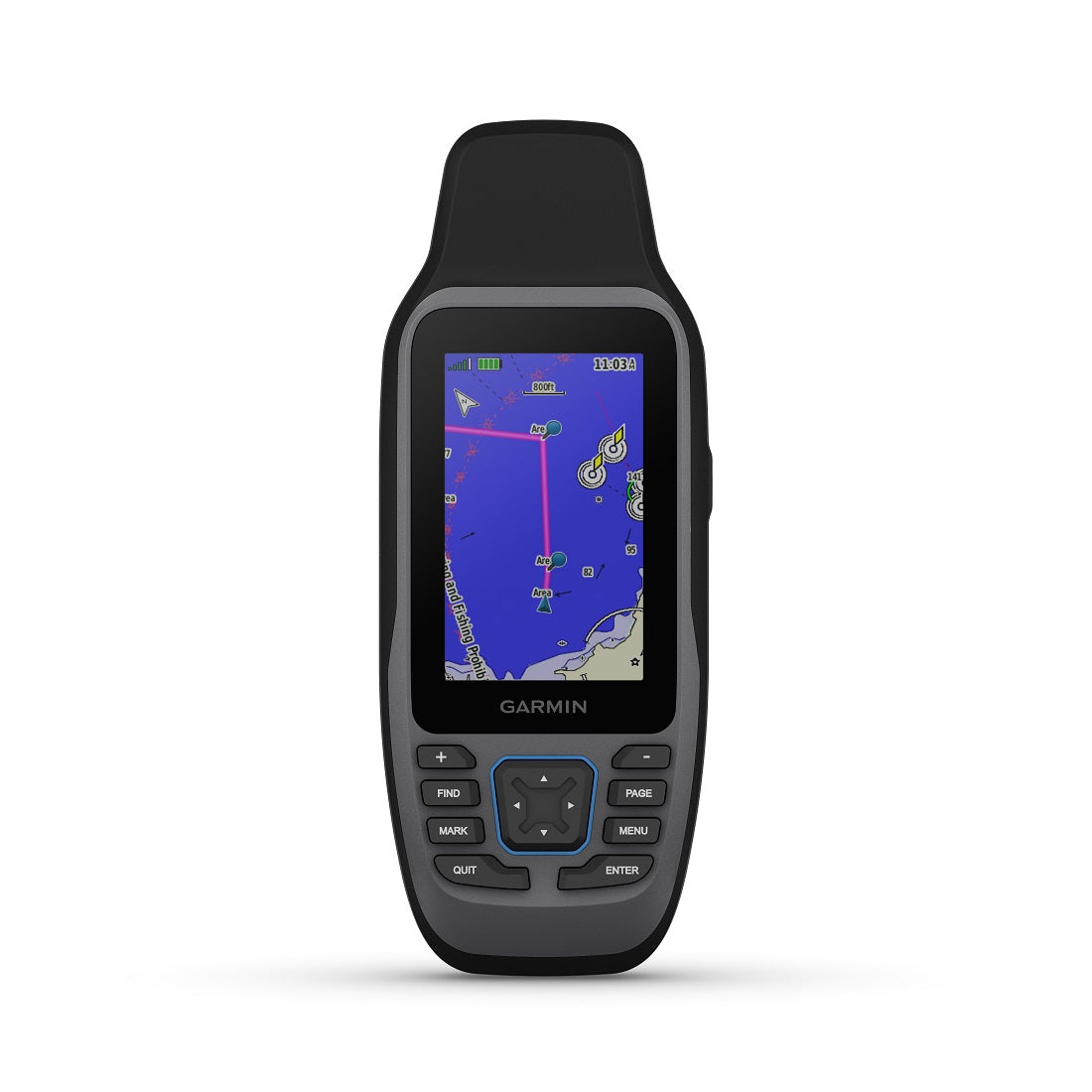
Garmin GPSMAP® 79sc - Marine Handheld Preloaded With BlueChart® g3 Coastal Charts
Model: 010-02635-02- Rugged, floating, water-resistant (IPX6 — unit level only) handheld GPS with a high-resolution color display and scratch-resistant, fogproof glass
- Increased memory to save and track 10,000 waypoints, 250 routes and 300 fit activities
- Supports multiple satellite constellations (GPS, GLONASS, Beidou, Galileo, QZSS and SBAS) for reliable tracking around the world
- Includes worldwide basemap
- Built-in 3-axis tilt-compensated electronic compass shows heading while standing still
- Barometric altimeter tracks changes in pressure to pinpoint your precise altitude
- Battery life: up to 20 hours in GPS mode
Cast off confidently with the GPSMAP® 79s marine GPS handheld. This rugged, floating handheld features a sunlight-readable, high-resolution color display that is fogproof and scratch-resistant. You get access to a range of satellite constellations, so you get more reliable, accurate tracking around the world. Navigate wherever your adventures take you with the worldwide basemap. With more memory than previous models, you can save and track 10,000 waypoints and 250 routes. Keep your bearings with the built-in compass.
This handheld is water-resistant (IPX7) with a high-resolution color display you can read in the sun. The glass is even scratch-resistant and fogproof.
If rough waters come and the handheld goes overboard, don’t worry. This device floats.
User-replaceable AA batteries (not included) provide up to 19 hours of battery life in GPS tracking mode.
With support for multiple satellite constellations — such as GPS, GLONASS, Beidou, Galileo, QZSS and SBAS — you’ll get accurate, reliable tracking and positioning around the world.
More memory than previous models means you can save and track 10,000 waypoints, 250 routes and 300 fitness activity files.
The 3-axis tilt-compensated electronic compass shows your heading — even while the boat is standing still.
Preloaded BlueChart g3 coastal charts (GPSMAP 79sc only) give you leading-edge coverage, clarity and detail with integrated Garmin and Navionics data.
SpecificationsGeneralPHYSICAL DIMENSIONS2.67'' x 6.85'' x 1.67'' (6.77 x 17.40 x 4.23 cm)DISPLAY SIZE1.5"W x 2.5"H (3.8 x 6.3 cm); 3" diag (7.6 cm)DISPLAY RESOLUTION240 x 400 pixelsDISPLAY TYPEtransflective, 65K color TFTWEIGHT9.95 oz (282g) with batteriesBATTERY TYPE2 AA batteries (not included); NiMH or Lithium recommendedBATTERY LIFEup to 19 hoursWATER RATINGIPX7MIL-STD-810yes (thermal, shock, water); bare unit onlyHIGH-SENSITIVITY RECEIVERYesINTERFACEhigh speed microUSB and NMEA 0183 compatibleMEMORY/HISTORY8 GB (user space varies based on included mapping on sc version)Maps & MemoryPRELOADED MAPSBlueChart® g3 Coastal ChartsABILITY TO ADD MAPSYesBasemapYesAUTOMATIC ROUTING (TURN BY TURN ROUTING ON ROADS) FOR OUTDOOR ACTIVITIESYes (with optional mapping for detailed roads)MAP SEGMENTS15000INCLUDES DETAILED HYDROGRAPHIC FEATURES (COASTLINES, LAKE/RIVER SHORELINES, WETLANDS AND PERENNIAL AND SEASONAL STREAMS)Yes (downloadable from Garmin Express™)INCLUDES SEARCHABLE POINTS OF INTERESTS (PARKS, CAMPGROUNDS, SCENIC LOOKOUTS AND PICNIC SITES)Yes (downloadable from Garmin Express™)DISPLAYS NATIONAL, STATE AND LOCAL PARKS, FORESTS, AND WILDERNESS AREASYes (downloadable from Garmin Express™)EXTERNAL MEMORY STORAGEyes (32 GB max microSD™ card, not included)WAYPOINTS/FAVORITES/LOCATIONS10000TRACKS250TRACK LOG20,000 points, 250 saved gpx tracks, 300 saved fit activities20,000 points, 250 saved gpx tracks, 300 saved fit activities250, 250 points per route; 50 points auto routingRINEX LOGGINGYesSensorsGPSYesGLONASSYessGalileoYesQZSSYesCompassYes (tilt-compensated 3-axis)GPS COMPASS (WHILE MOVING)YesOutdoor RecreationPOINT-TO-POINT NAVIGATIONYesAREA CALCULATIONYesHUNT/FISH CALENDARYesGEOCACHING-FRIENDLYYes (Paperless)CUSTOM MAPS COMPATIBLEYesPICTURE VIEWERYes
What's in the Box:
- GPSMAP 79s
- Lanyard
- USB Cable
- Documentation